Site 16. Noss Head Y Station
During the Second World War Caithness was home to many vital military installations. To prevent knowledge of these stations leaking out Caithness was made a High-Security Area. Special security passes were needed by everyone, military and civilian alike, to enter or move around within the county.
A number of these installations were top secret wireless stations, the most secret and clandestine of which were the stations of the Y Service.
The function of the Y Service was to monitor all enemy wireless transmissions, not just the content, but also where they were being transmitted from. This was the purpose of the Y stations in Caithness. Using directional receivers the operators could accurately determine the bearing of a particular transmission. This information was passed back to a central HQ and combined with directional information from other stations located in the Borders and the south of England. These bearings were then triangulated onto a map to pinpoint the exact source of the transmission. This information was then passed on to Bletchley Park in Bedfordshire where it helped in breaking the German Enigma codes and contributed to the ‘Ultra’ information, which made such a significant contribution to hastening the end of the war.
Each British military service had its own Y stations in Caithness, and each monitored the transmissions of its enemy equivalent, so the RAF monitored the Luftwaffe (German air force), the navy monitored the Kriegsmarine (German navy) and the army monitored the Heer (German army). A fourth service, the RSS (Radio Security Service) was tasked with monitoring German government and Gestapo transmissions.
The stations themselves were distributed around the county out of each other’s way. The RAF operated from Noss Head, the navy from Bower, the army from Claredon and Geiss near Thurso, and the RSS from Halkirk.

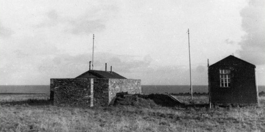
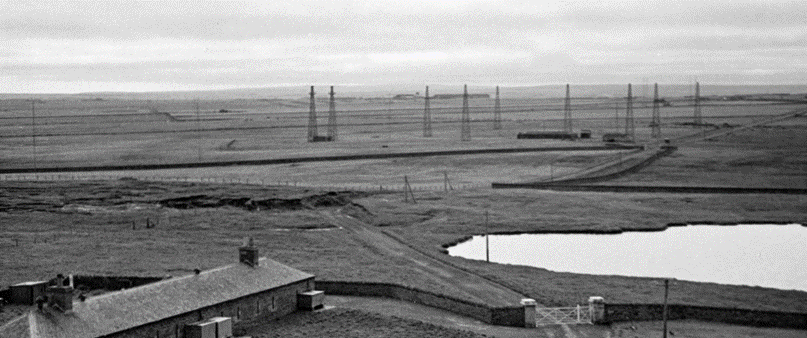
They employed a technique called RDF (Radio Direction Finding) which used a system of directional antennae called an Adcock Array. The wireless stations themselves were fairly small affairs, usually a small hut with four aerials set around it. Inside the hut the operator used a special receiver to scan round the signals received from the antennae until he found the position that had the strongest response. This gave the direction from which the signal came.
Normally there were two sites at each station, one monitoring high frequency transmissions and the other monitoring medium frequency transmissions.
Due to the nature of radio signals the HFDF (High Frequency Direction Finding) site required aerials about 20 feet high (6m) and so could be accommodated in an area about the size of a large garden. The MFDF (Medium Frequency Direction Finding) site needed aerials of about 100 feet in height (30m) and consequently required a much larger area.
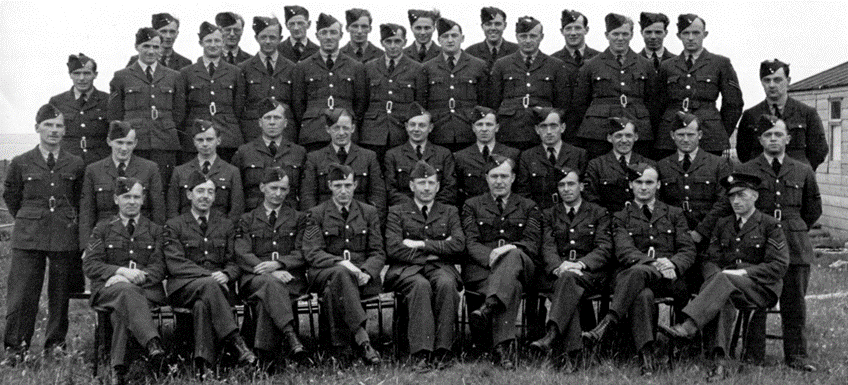
Operating a 24 hour, three shift system required quite a large number of men to operate the site. Noss Head for example had a crew of 39 men of the RAF Signals Section.

After the war some of these stations continued to operate but, as the Cold War developed, their focus was on Soviet transmissions. As a result of this the RAF’s site at Noss Head and the navy’s site at Bower were both expanded. The army stations at Claredon and Geiss were closed down along with the RSS station at Halkirk.
In 1967 all UK wireless interception operations were transferred to GCHQ (Government Communications Headquarters) in the west of England as part of their Composite Signals Organisation. The station at Bower was further expanded and continued operating until 1977. The Noss Head station appears to have continued as it was until at least 1975.

There is now little to be seen of these stations but Noss Head does retain some of its original Second World War structures. The blast walls that protected the HFDF hut can still be seen along with the remains of an air raid shelter beside it.
The remains of a wireless station for RAF Wick can still be seen by the car park near the lighthouse but this had no connection with the Y Service activities.


